顯示包含「california」標籤的文章。顯示所有文章

星期六, 10月 10, 2009

Mission Peak


Date: 10/10/09
Park: Mission Peak, Fremont, CA
Condition: Sunny and cool day and a little bit of fog. Some breezy, not too cold.
Start time: around 12:00 PM
Length: About 5 Hours
Hiker: JC
Trail: http://www.bahiker.com/eastbayhikes/missionpeak.html
Map: Map
Pictures: http://www.jc-studios.org/JC-Hiking/Mission-Peak-20091010/9922394_EW5eN/1/676682964_9UpDE
Views: The bay, Mt Diabio, Del Valle. Some birds, squirrel, cow, falcon, crow. Skydivers. The new hiking shoe finally break in and no more blister this time. I ran into the ranger, he ask me will I make it to the top, I said I will in about an hour.... I did.... I might be slow but not a quitter... The rocky and sandy top is a problem for my balancing but persistence helped. There is an amazing thing I saw when I walk downhill... There are noises on the side, when I look, the squirrels are running around, and the falcon got one and flying away.... I would so much imagine what it would be like if I caugh the scene in camera....

星期日, 10月 19, 2008

Pinnacles National Monument

Date: 10/18/08
Park: Pinnacles National Monument
Hikers: Sarah, Monica, Maria, CY, Matthew, Edward, Vivian, JC
Trail: Moses Spring–Rim Trail Loop + Condor Gulch–High Peaks Loop
Length: 5.5 hrs 6.1 miles + hike to the other parking lot
Start time: around 1:00PM
Condition: Sunny and hot
Pictures: http://jc-studios.smugmug.com/gallery/6300254_CcVzB
Views: Strange rock formation, rock climbing, cave, nice lake, stinky springs =P. We saw 3 deers. Parking is tight, there is no space at the Bear Gulch area. So we split into 2 groups. Group 1 had a headstart. Group 2 will catch up. The trail is quiet exposed in the beginning and most of us almost ran out of water. Group 2 caught up at almost 2 hours into the hike. They were so fast. These old legs and old shoulders of mine held up and successfully finished the hike w/o any incident and on time. Thank God and thanks everyone that waited for this slow snail....

星期日, 3月 04, 2007

Mission Peak

Date: 03/03/07
Park: Mission Peak, Fremont, CA
Condition: Sunny and warm day and a little bit of fog
Start time: around 1:00 PM
Length: About 5 Hours
Hiker: JC, Monica, Maria, Jackie
Trail: http://www.bahiker.com/eastbayhikes/missionpeak.html
Map: Map
Pictures: http://jc-studios.smugmug.com/gallery/2539980
Views: It took us a while to get started, deciding bring windbreaker or not. We are glad that we did. It was very windy on the top. We had expected the trail to be muddy but no mud whatsoever. Nice. We got a panoramic views of the bay area. San Francisco downtown is blurry but visible. The Dumbarton and San Mateo Bridge. A few birds, a few falcons. A couple squirrels and plenty of cows. The hill is so green, I guess the cows are having the best grass of the year at this moment.... Hahaha.... There were even a couple of parachutes and a kite. There were a few reservoirs on the east side. Lake Elizabeth in Fremont. The trail was tough, I have not exercise for a while. We rested a lot. Maria and the gang were singing all the way up there. And singing down too.... We stayed quite a while at the top and visited the peak. We were slipping all the way down. Also the winds almost blew off some one's cap.... Hahaha.... It was a fun hike... Too bad I got a ticket when we returned.

星期一, 2月 19, 2007

Yosemite

Date: 02/19/07
Park: Yosemite National Park, CA
Condition: Sun and clouds
Start time: around 3:30PM
Length: About 3 Hours
Hiker: JC, Monica, Sarah, Maria, Yvonne
Trail: Ad Hoc
Map: Maps
Pictures: To be posted
Views: We got there and spent some time looking for food. Only the deli is opened. I got a kid's lunch and the peanut butter sandwich is horrible. I knew before I bought it and I got it because it got a gel dessert and an apple.... There was a line at the microwave so it took us a long time to finish lunch. We then decide to go to Vernal/Nevada Falls trail. Then on the shuttle bus, we decided to just go to the Merced river beach and meadows. We just took 2 stops and walk along the river. We took plenty of pictures of the upper falls and half dome. Half dome is hiding behind clouds most of the time. And upper falls have a very high contrast with the Merced River. We also walked to the Lower Falls trail. We even climb the rocks to the base of the Lower Fall... Then we tried to walk back to the parking lot... We saw some deer having their supper. We almost got lost but somehow got it right.... We spend 15 minutes trying to eat a Pamelo after we got to our car.... Some supper I supposed.... I also finished the half peanut butter sandwich... After a couple hours of body temperature. The sandwich tasted a lot better...

星期六, 2月 10, 2007

Don Edwards Wildlife Refuge

Date: 02/10/07
Park: Don Edwards Wildlife Refuge, Alviso, CA
Condition: Sunny and warm day but windy with clouds there
Start time: around 4:30 PM
Length: About 2 Hours
Hiker: JC, Monica
Trail: Ad Hoc
Map: None
Pictures: http://jc-studios.smugmug.com/gallery/2487451
Views: We got off at the Alviso Marina. We did not hike long, we just hike a short while and were distracted by sea gulls.... Lots and lots of sea gulls. The were flying towards us, non-stop. We got there just in time for the setting sun also... So both me and Monica took pictures of the birds, the setting sun, the clouds, the bay waters and each other taking pictures. There were trains going by also. Our hands are freezing after dark.

星期日, 2月 04, 2007

Memorial County Park

Date: 02/03/07
Park: Memorial County Park, Pescadero, CA
Condition: Sunny, warm, hazy
Start time: around 1:30 PM
Length: Less than 3 Hours
Hiker: JC, Maria, Monica
Trail: http://www.bahiker.com/southbayhikes/memorial.html
Map: Here
Pictures: http://jc-studios.smugmug.com/gallery/2429844
Views: There are a lot of redwood trees and fir. The trail is quite shady. The trail is a little bit soft but not very muddy. Lots of obsticles on the path, trigs, branches, trees, and places with very narrow trail. We saw a few banana slugs. Monica almost slip and fell off the cliff. JC has to rest a few times going up the trails but is not too bad for this out of shape gal..... Another funny story, JC put the yellow ticket on the dash board after we paid at the self registration kiosk. After we parked, the ticket slipped in the defrost air duct of my car. I tried to get it out and it slipped in further. Finally, we just write a slip that we paid the registration fee. JC is so stupid.

星期一, 1月 22, 2007

Quarry Lakes

Date: 01/20/07
Park: Quarry Lakes, Fremont, CA
Condition: Sunny, warm
Start time: before 2:30 PM
Length: Less than 3 Hours
Hiker: JC
Trail: From my house to the Park and back
Map: None
Pictures: http://jc-studios.smugmug.com/gallery/2375839
Views: There were views of East Bay Hills and different kinds of ducks. There were a couple of people flying kites and one were using wind power for his cart. I was riding in circles trying to get to a later time so that I could catch the sunset but eventually I didn't. The blueskies and reflections are pretty enough after that grey weather.

星期六, 1月 06, 2007

Alameda Creek

Park: Alameda Creek, Fremont/Newark/Union City, CA
Pictures: http://jc-studios.smugmug.com/gallery/2323959

星期三, 1月 03, 2007

Edgewood Park

Date: 12/16/06
Park: Edgewood Park, Redwood City, CA
Condition: Sunny, cool
Start time: before 1:00 PM
Length: About 2 Hours (around 5 miles)
Hiker: JC, Maria, Sarah, Noelle
Trail: http://www.bahiker.com/southbayhikes/edgewood.html
Map: Map
Pictures: http://jc-studios.smugmug.com/gallery/2247686
Views: We have the honor to hike with Noelle just when she return to the bay area. The weather is cooperating. It was raining the days before Saturday. The trail is quite flat and not very difficult. We saw a pretty bird standing above the information kiosk, green vegetation, and some fall colors. There is a vista of the south bay also.

星期日, 11月 05, 2006

Monte Bello Open Space Preserve

Date: 11/04/06
Park: Monte Bello Open Space Preserve, Los Altos Hills, CA
Condition: Sunny, cool but muggy and foggy
Start time: before 2:00 PM
Length: About 3 Hours (around 6 miles)
Hiker: JC, Maria, Louisa, Monica
Trail: http://www.bahiker.com/southbayhikes/monte.html
Map: Map
Pictures: http://jc-studios.smugmug.com/gallery/2094321
Views: The trail is very pretty and we took plenty of pictures. I thought there is a lone tree that I got pictures at 2 different angles last time. It turns out to be 2 totally different trees. There are views of the bay but it was quite foggy. The leaves are changing yellow and they were very pretty. The trail is shady for some part and other part is quite open. We expect it to get muddy since it rained for a couple days last week but it was not muddy yet. We saw a couple deers while driving and hiking. We also amazed at the full moon rising towards the end of the hike. All in all a very nice walk for the fall season. The only problem is the trail goes down first then up and also I got very sweaty while hiking up

星期六, 10月 14, 2006

Dumbarton Bridge 84 biking

Posted by Picasa
Date: 10/14/06
Park: Don Edwards Wildlife Refuge, Newark, CA and Ravenswood Wildlife Refuge, Menlo Park, CA
Condition: Cloudy in the morning, Sunny and breezy
Start time: About 3:45 PM
Length: About 1 Hours
Biker: JC
Trail: AdHoc
Trail Map: N/A
Pictures: http://jc-studios.smugmug.com/gallery/2006437
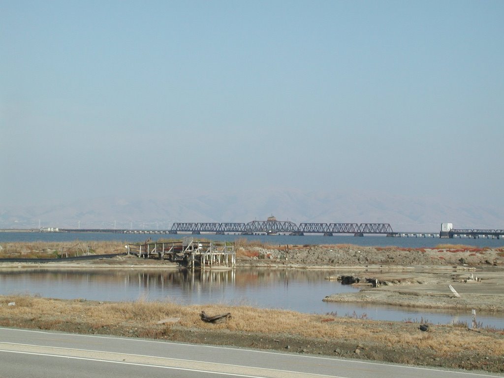
Views: The bay, East Bay, Peninsula and fuzzy SF. The bridge and a few sloughs. The abandon railroad track across the bay. There are some tiny birds and long stilks black birds. It was quite windy that my helmet is flipping over my head. My visor is no longer protecting my eye. It is not as difficult as I anticipated. Next time I could bike further.

星期六, 10月 07, 2006

Portola State Park

Date: 10/07/06
Park: Portola Redwood State Park/Pescadero Creek County Park, Woodside, CA
Condition: Sunny and cool
Start time: About 12:00 PM
Length: About4 Hours (around 5 miles)
Hiker: JC, Ceci
Trail: http://www.bahiker.com/southbayhikes/portola.html
Trail Map: Map
Pictures: http://jc-studios.smugmug.com/gallery/1978214
Views: The trail is quite shady for the most part and the weather is good for hiking. There are plenty of evergreen trees growing everywhere. Redwoods and others. The trail runs along Pascadero Creek for a while, we visited tip toe fall. The leaves are starting to turn orange and yellow but they are not extensive yet. We missed a turn at Old Haul Road and spent an extra hour there. The trail is a little bit tough at almost the end but it is not too bad. It rained previous days so plenty of banana slug on the trail. We were looking for five finger fern and huckleberry but couldn't figure out how they look like.

The drive back on 84 is so exciting but my passenger is fast asleep just like my other one.