Date: 02/19/07
Park: Yosemite National Park, CA
Condition: Sun and clouds
Start time: around 3:30PM
Length: About 3 Hours
Hiker: JC, Monica, Sarah, Maria, Yvonne
Trail: Ad Hoc
Map: Maps
Pictures: To be posted
Views: We got there and spent some time looking for food. Only the deli is opened. I got a kid's lunch and the peanut butter sandwich is horrible. I knew before I bought it and I got it because it got a gel dessert and an apple.... There was a line at the microwave so it took us a long time to finish lunch. We then decide to go to Vernal/Nevada Falls trail. Then on the shuttle bus, we decided to just go to the Merced river beach and meadows. We just took 2 stops and walk along the river. We took plenty of pictures of the upper falls and half dome. Half dome is hiding behind clouds most of the time. And upper falls have a very high contrast with the Merced River. We also walked to the Lower Falls trail. We even climb the rocks to the base of the Lower Fall... Then we tried to walk back to the parking lot... We saw some deer having their supper. We almost got lost but somehow got it right.... We spend 15 minutes trying to eat a Pamelo after we got to our car.... Some supper I supposed.... I also finished the half peanut butter sandwich... After a couple hours of body temperature. The sandwich tasted a lot better...
星期六, 2月 10, 2007
Don Edwards Wildlife Refuge
 Date: 02/10/07
Park: Don Edwards Wildlife Refuge, Alviso, CA
Condition: Sunny and warm day but windy with clouds there
Start time: around 4:30 PM
Length: About 2 Hours
Hiker: JC, Monica
Trail: Ad Hoc
Map: None
Pictures: http://jc-studios.smugmug.com/gallery/2487451
Views: We got off at the Alviso Marina. We did not hike long, we just hike a short while and were distracted by sea gulls.... Lots and lots of sea gulls. The were flying towards us, non-stop. We got there just in time for the setting sun also... So both me and Monica took pictures of the birds, the setting sun, the clouds, the bay waters and each other taking pictures. There were trains going by also. Our hands are freezing after dark.
星期日, 2月 04, 2007
Memorial County Park
 Date: 02/03/07
Park: Memorial County Park, Pescadero, CA
Condition: Sunny, warm, hazy
Start time: around 1:30 PM
Length: Less than 3 Hours
Hiker: JC, Maria, Monica
Trail: http://www.bahiker.com/southbayhikes/memorial.html
Map: Here
Pictures: http://jc-studios.smugmug.com/gallery/2429844
Views: There are a lot of redwood trees and fir. The trail is quite shady. The trail is a little bit soft but not very muddy. Lots of obsticles on the path, trigs, branches, trees, and places with very narrow trail. We saw a few banana slugs. Monica almost slip and fell off the cliff. JC has to rest a few times going up the trails but is not too bad for this out of shape gal..... Another funny story, JC put the yellow ticket on the dash board after we paid at the self registration kiosk. After we parked, the ticket slipped in the defrost air duct of my car. I tried to get it out and it slipped in further. Finally, we just write a slip that we paid the registration fee. JC is so stupid.
星期一, 1月 22, 2007
Quarry Lakes
 Date: 01/20/07
Park: Quarry Lakes, Fremont, CA
Condition: Sunny, warm
Start time: before 2:30 PM
Length: Less than 3 Hours
Hiker: JC
Trail: From my house to the Park and back
Map: None
Pictures: http://jc-studios.smugmug.com/gallery/2375839
Views: There were views of East Bay Hills and different kinds of ducks. There were a couple of people flying kites and one were using wind power for his cart. I was riding in circles trying to get to a later time so that I could catch the sunset but eventually I didn't. The blueskies and reflections are pretty enough after that grey weather.
星期六, 1月 06, 2007
Alameda Creek
 Park: Alameda Creek, Fremont/Newark/Union City, CA
Pictures: http://jc-studios.smugmug.com/gallery/2323959
Avalanche sweeps cars off U.S. 40 in Colorado - USATODAY.com
Avalanche sweeps cars off U.S. 40 in Colorado - USATODAY.com
Wow, I never thought an highway as busy and popular as Interstate 40 will have this kind of an accident. Cars are swept from the highway by an avalanche. We were so lucky when we drove on Hwy 40 and it was snowing at Arizona. Thank You the big guy above for keep us safe the whole trip. Be careful if you are driving Hwy 80/50 to Tahoe. Happy driving!!!
God Bless, JC
星期三, 1月 03, 2007
Arizona Christmas Trip
 Date: Christmas 12/21-26 2006
Park: Sunset Crater, Petrified Forest, Red Rock State Park, Montezuma Castle and Wells, AZ and Mojave Preserve, CA
Condition: Sun and Clouds, Rain and Snow.
Trail: No specific record
Hikers: Me, Mug, Sarah, Pak
Pictures: Coming Soon
12/21 - Drive to Mojave
12/22 - Flagstaff - Sunset Crater National Monument, Drive to Sedona
12/23 - Sedona - Oak Creek Canyon, Holbrook - Petrified Forest National Park, Sunday Vigil Mass
12/24 - Sedona - Boynton Pass, Red Rock State Park, Christmas Vigil Mass
12/25 - Sedona - Chapel of the Holy Cross, Oak Creek Village, Montezuma Castle National Monument, Montezuma Wells National Monument, Drive to Needles
12/26 - Mojave National Preserve, Drive home
Highlights: Snow and rain on the first 2 driving days. They were so pretty, we saw them in Williams, Flagstaff and Sedona. We saw a coyote walking across the highway, an UFO one night when we were driving. The snow was so pretty at Sunset Crater, we got there just before closing. The drive out of Sedona to Flagstaff is so pretty, snow everywhere. We saw a snowman beside the highway. The lady at our inn told me they don't get snow too often. The highway is Oak Creek Canyon Road. We went to route 66 when we almost get petrified, find all the petrified trees and forest. Sedona is pretty at the Red Rock State Park, the Cathedral Rock is pretty, we got there around sunset. Oh man, our God is so awesome. We attended a good Christmas Vigil mass at Sedona. The Chapel of the Holy Cross is spectacular, although the chapel itself was closed on Christmas day. We have drive big circles on Christmas day, first to take pictures of the sunset, without finding a decent location. Second to look for an early dinner at Flagstaff without finding one, every where is closed and dark. Third at Williams for a bathroom and dinner and getting very desperate. Thank God we finally get relief and get some hamburgers before the only Jack in the Box that opens ran out of items in the menu and closed early for the holidays. Needles is very confusing because it sounded like "here" in Cantonese. We stayed there the final night. We tried to visit the cavern in Mojave Preserve but it was not open until 1:00 PM. We went to the sand dunes instead, but the lighting is not very good to give it a good contrast for pictures. JC is getting knee problems and the last 2 days are handicapped or "legicapped". The pig and horse and cat and dog can not communicate with each other well, hopefully we will do better next time.
Edgewood Park
 Date: 12/16/06
Park: Edgewood Park, Redwood City, CA
Condition: Sunny, cool
Start time: before 1:00 PM
Length: About 2 Hours (around 5 miles)
Hiker: JC, Maria, Sarah, Noelle
Trail: http://www.bahiker.com/southbayhikes/edgewood.html
Map: Map
Pictures: http://jc-studios.smugmug.com/gallery/2247686
Views: We have the honor to hike with Noelle just when she return to the bay area. The weather is cooperating. It was raining the days before Saturday. The trail is quite flat and not very difficult. We saw a pretty bird standing above the information kiosk, green vegetation, and some fall colors. There is a vista of the south bay also.
星期日, 12月 31, 2006
Grand Canyon Age
Check out the link.
http://www.moonbuggy.org/archive/2006/12/31/how-old-is-the-grand-canyon-park-service-wont-say/
National Park Service seems to be confused with science and piety. Or they are just trying to be politically correct. I believe the age of the canyon has no conflict with God's creation. God's measure of time is most likely different from ours since He created time. So in terms of human time, the rocks are billions and billions of years old would not uproot my believe in God or He created the canyon. Nor if the canyon is created by Noah's flood would convince anyone to start believing.
-------------------
We have learnt today (1/20/2007) that this news is bogus.
星期日, 11月 05, 2006
Monte Bello Open Space Preserve
 Date: 11/04/06
Park: Monte Bello Open Space Preserve, Los Altos Hills, CA
Condition: Sunny, cool but muggy and foggy
Start time: before 2:00 PM
Length: About 3 Hours (around 6 miles)
Hiker: JC, Maria, Louisa, Monica
Trail: http://www.bahiker.com/southbayhikes/monte.html
Map: Map
Pictures: http://jc-studios.smugmug.com/gallery/2094321
Views: The trail is very pretty and we took plenty of pictures. I thought there is a lone tree that I got pictures at 2 different angles last time. It turns out to be 2 totally different trees. There are views of the bay but it was quite foggy. The leaves are changing yellow and they were very pretty. The trail is shady for some part and other part is quite open. We expect it to get muddy since it rained for a couple days last week but it was not muddy yet. We saw a couple deers while driving and hiking. We also amazed at the full moon rising towards the end of the hike. All in all a very nice walk for the fall season. The only problem is the trail goes down first then up and also I got very sweaty while hiking up
星期六, 10月 14, 2006
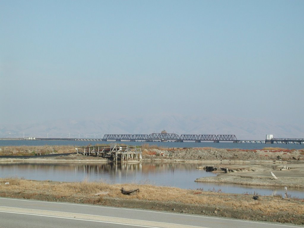
Dumbarton Bridge 84 biking

Date: 10/14/06
Park: Don Edwards Wildlife Refuge, Newark, CA and Ravenswood Wildlife Refuge, Menlo Park, CA
Condition: Cloudy in the morning, Sunny and breezy
Start time: About 3:45 PM
Length: About 1 Hours
Biker: JC
Trail: AdHoc
Trail Map: N/A
Pictures: http://jc-studios.smugmug.com/gallery/2006437
Views: The bay, East Bay, Peninsula and fuzzy SF. The bridge and a few sloughs. The abandon railroad track across the bay. There are some tiny birds and long stilks black birds. It was quite windy that my helmet is flipping over my head. My visor is no longer protecting my eye. It is not as difficult as I anticipated. Next time I could bike further.
星期六, 10月 07, 2006
Portola State Park
 Date: 10/07/06
Park: Portola Redwood State Park/Pescadero Creek County Park, Woodside, CA
Condition: Sunny and cool
Start time: About 12:00 PM
Length: About4 Hours (around 5 miles)
Hiker: JC, Ceci
Trail: http://www.bahiker.com/southbayhikes/portola.html
Trail Map: Map
Pictures: http://jc-studios.smugmug.com/gallery/1978214
Views: The trail is quite shady for the most part and the weather is good for hiking. There are plenty of evergreen trees growing everywhere. Redwoods and others. The trail runs along Pascadero Creek for a while, we visited tip toe fall. The leaves are starting to turn orange and yellow but they are not extensive yet. We missed a turn at Old Haul Road and spent an extra hour there. The trail is a little bit tough at almost the end but it is not too bad. It rained previous days so plenty of banana slug on the trail. We were looking for five finger fern and huckleberry but couldn't figure out how they look like.
The drive back on 84 is so exciting but my passenger is fast asleep just like my other one.
星期六, 9月 30, 2006
Pinnacles National Monument
 Date: 09/30/06
Park: Pinnacles National Monument, Hollister, CA
Condition: Sunny and cool
Start time: About 12:00 PM
Length: About 5 Hours (around 5 miles)
Hiker: JC, Maria, Pak, Belinda
Trail: High Peak Loop, Condor Gulch, Moses Springs, Rim Trail
Trail Map: N/A
Pictures: http://jc-studios.smugmug.com/gallery/1956721
Views: We went to the East side again and we forgot to bring the map for Hollister. Mug wants to use that Google Mobile Search again. Uh oh.... It keeps on sending us directions. $0.10 per beep. Oh no... Actually, we did not get too far away from our right path. We got to a gas station, check the map and got back to the right track. When we got there, it was still a little bit cloudy. The sun peeked out towards the end of the hike. We got some nice pictures. We visited the Reservoir and it has plenty of ripples. The ripples are caused by frogs breathing under the water. We did not see any though. We pass though some caves towards the end and I fell and also hit my head. When we get back to the parking lot, I found I have blood on my pants. Anyway, it was just minor injury. We had a nice Italian Dinner at Gilroy and the waitress is very nice to us. A very good day.
星期六, 9月 16, 2006
Long Ridge
 Date: 09/16/06
Park: Long Ridge Open Space Preserve, Woodside, CA
Condition: Sunny and nice
Start time: About 2:00 PM
Length: About 2-3 Hours (around 5 miles)
Hiker: JC, Maria, Alan and Meiling
Trail: http://www.bahiker.com/southbayhikes/longridge.html
Trail Map: Map
Pictures: http://jc-studios.smugmug.com/gallery/1899521
Views: The trail is quite shady for the most part and the weather is good for hiking. There are layers and layers of mountains and evergreen trees grow everywhere. Redwoods and others. Several parts are quite steep and we need to rest along the climb. We saw an Elephant Idol beside the creek under the bridge. We wonder if it was some recent festival. We also walk by a pond overgrown by vegetation. We met a few mountain bikers a few times. Since the trail is not very long, less than 5 miles, next time we could extend the hike as suggested. We finished the hike pretty early and we drove down to highway 1 and visit the beach. We were very close to the waves. So cool. Somehow Maria asked me to bring a jacket when the weather is warm, I comply without hesistation (which is quite odd) and it became useful at the beach, I lend it to Meiling which is freezing. If they had all got enough clothes, I have been staying there to take more pictures. Anyway, this is good enough.
星期六, 9月 09, 2006
Stevens Creek Reservoir
Date: 09/09/06
Park: Stevens Creek Reservoir, Cupertino, CA
Condition: Sunny and quite hot
Start time: About 2:00 PM
Length: About 3 Hours (around 6 miles)
Hiker: JC, Maria, Shih-hsin, Cindy
Trail: http://www.bahiker.com/southbayhikes/stevenscreek.html
Trail Map: N/A
Pictures: N/A
Views: JC is so exhausted that she skip taking pictures. The reservoir is calm and pretty as usual. We found out that we were parking illegally for the past few times we came inside the parking lot. Thank God we did not get any ticket. JC needs to work out more or rehabilitate to walk. Left hand and feet are still quite stiff and inmobile. Hopefully it is only ergonormic problems and will go away soon once JC figure out what is causing them.
星期一, 9月 04, 2006
Sweeney Ridge
 Date: 09/06/06
Park: Sweeney Ridge Trail, Golden Gate National Recreation Area, Pacifica, CA
Condition: Sunny with some fog
Start time: About 2:00 PM
Length: About 3 Hours (almost 6 miles)
Hiker: Jeffery, Grace, Grace's sister, Lucian, Monica, James, Edison, Andrew, Renata, Toby, Timmy, Andrew, Jen, Maria, Sarah, Yvonne, JC Allen, Christine, Kenny
Trail: http://www.bahiker.com/southbayhikes/sweeney.html
Trail Map: Map
Pictures: http://jc-studios.smugmug.com/gallery/1855144
Views: A very nice day in Pacifica. There is a paranomic view around San Franciso. We saw views of Crystal Springs Reservoir, SFO, surrounding hills and the Pacific Ocean. We have 2 children with us and they finished the hike. Woohoo.... Good job!!! Plenty of Trees and some wild flowers. Plants everywhere. We stopped at the discovery site and view around with the binoculars. We trace a few Bay Area mountains there, Mission Peak, Mt Diablo. Hopefully it would be a clearer day next time for more mountain identification. Fog fell among us almost the end of the hike and it gets windy and cold.
星期六, 9月 02, 2006
Fall Creek Unit, Henry Cowell State Park
 Date: 09/02/06
Park: Henry Cowell State Park, Felton, CA
Condition: Sunny
Start time: About 1:50 PM
Length: About 4 Hours (almost 7 miles)
Hiker: Pak, Sarah, Yvonne, JC and Maria
Trail: http://www.bahiker.com/southbayhikes/fallcreek.html
Trail Map: N/A
Pictures: http://jc-studios.smugmug.com/gallery/1846235
Views: Plenty of redwood trees. Fall Creek and plenty of small waterfalls. Lots of fallen trees and exposed roots. Part of the trails are quite wet and muddy. JC is careful not to get overheat because parts of the trail are steep ascend. We were getting hungry after a while and Yvonne has granola bars so that we could regain some energy. Sarah, Yvonne, JC and Pak took some pictures. This is a nice shady trail for the summer. If the breeze is stronger, then it would be perfect.
星期六, 8月 26, 2006
Rancho San Antonio
 Date: 08/26/06
Park: Rancho San Antonio, Mountain View, CA
Condition: Sunny
Start time: About 4:00 PM
Length: About 2 Hours
Biker: JC and Maria
Trail: Wildcat Loop
Trail Map: http://www.openspace.org/preserves/maps/rancho_san_antonio_map.pdf
Pictures: http://jc-studios.smugmug.com/gallery/1820252
Views: We went to San Antonio so often, nothing is really spectacular. This time we notice some violet flowers, quail and some cotton like flower trees.
星期六, 8月 19, 2006
Don Edwards, Alviso
 Date: 08/19/06
Park: Don Edwards National Wildlife Refuge, Alviso, CA
Condition: Sunny with a cool breeze
Start time: About 2:30 PM
Length: About 1.5 Hours
Biker: JC and Maria
Trail: Ad-hoc
Trail Map: N/A
Pictures: http://jc-studios.smugmug.com/gallery/1798017
Views: Nice view of the East Bay. Water is green, blue and orange. Animals include squarril, egret, brown pelican, white pelican, sea gulls, stilks. The birds are sitting on the orange stuff. They look like land but in fact, I think they are some kind of moss or sea weed. We are going to a party afterwards so we did not finish the trail. It is a nice ride and the views are spectacular.
星期三, 8月 02, 2006
Zion and Bryce Canyon 5 day trip
 Date: 07/19-23/2006
Park: Zion National Park and Bryce Canyon National Park
Condition: Sunny, Hot, Extreme Temperatures, Thunderstorms
Hikers: Me, Maria, Pak
Maps:
Bryce Canyon National Park
Zion Nation Park
Pictures: http://jc-studios.smugmug.com/gallery/1702649
Day 0 Travel to Zion National Park, Zion Visitor Center
Day 1 Zion - Watchman Trail, Riverside Walk, Weeping Rock, Lower Emerald Pool (Kayenta Trail)
Day 2 Zion - Angel's Landing, Mt Carmel Highway, Drive to Bryce Canyon National Park
Day 3 Bryce - Rim Trail, Queen's Garden Trail/Navajo Loop, Viewpoints, Drive to N. Las Vagas
Day 4 Travel Home
Highlights:
Raining Cats and Dogs near LV on our way to Zion
Very Hot in Zion, almost got heat stroke the first day, had thunderstorms in the afternoon
Even hotter in Zion the second day, nearly need to be carried out by ranger. Another Thunderstorm approaching in the afternoon.
Happy Snapping the lightning in Bryce.
Better Temperature in Bryce, Hoodoos are awesome. Walking down the canyon is cool.
Saw Deer, Ravens, chipmunks, lizards
In this trip, switchbacks are my friend, can not spent a day without it.
Lesson Learnt: Bring plenty of water with Gatorade
Thank God for the experience and friendship and the wonderous creation
訂閱:
文章 (Atom)